Indonesia is part of the 'Ring of Fire', a part of the world that follows the earth's tectonic plates which encircle the Pacific Ocean and is home to hundreds of volcanoes many of which are active.
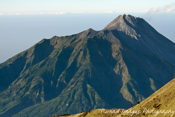
Gunung Merapi (2930m, northern flank) as seen from Gunung Merbabu
Gunung Merapi or Mount Merapi (gunung means mount or mountain in the Indonesian language) is one of Indonesia's most active volcanoes in fact it is actually listed in the 'world's most active volcanoes'! It has a fiery history if you will pardon the pun...Quite literally the name given to it 'Gunung Merapi' means mountain of fire.
It has a history of regular and formidable eruptions dating as far back as 1548. Within the last couple of decades it has been particularly dangerous to the local inhabitants. In 1994 hot gas from an explosion killed 27 people, in 2006 another major eruption changed the actual summit area of Merapi and this was the beginning of the end for the longstanding and famous Puncak Garuda (puncak means peak or summit).
Fast forward to the year 2010 and we have an eruption that completely changes the summit altogether. The lava dome that was created after the 2006 eruption disappears revealing a huge crater some 200m deep and 500m wide which we see to this day.
The 2010 eruption killed around 300 people, the majority of which lived in villages on the slopes of the mountain. Now Mount Merapi puncak or peak is 38m lower than before the eruption, the present height is 2,930m compared to 2,968m.
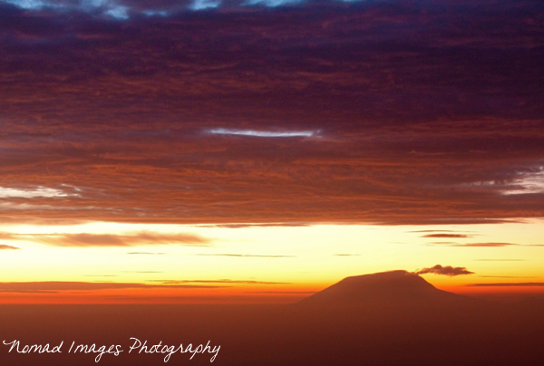
Gunung Lawu viewed from Puncak Merapi
Gunung Merapi is safe to climb at the moment but it is always worth checking with locals or at the pos (checkpost) before attempting an ascent. When I did it last month it was 5 days after a minor eruption and I had made sure the warning had been downgraded to safe before ascending. I had heard there was some glowing lava to be seen in the depths of the twisted and gnarled, ney, sinister crater but what I saw at the time was somewhat of a letdown due to the huge amount of sulphurous gas billowing out of the crater. It was impossible to see into the crater due to this.
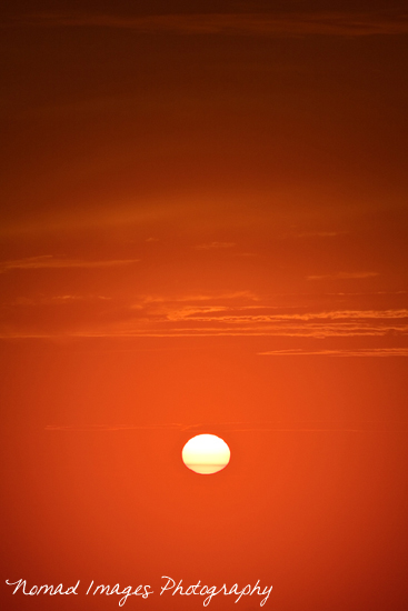
Sunrise viewed from Mount Merapi
Gunung Merapi is reached from two main starting points, Kaliurang in the south which is a short distance from Yogyakarta or from Selo to the north which is a small village/town nestled at altitude, 1300m a.s.l to be precise between Gunung Merapi and Gunung Merbabu and accessed from Boyolali to the east or from Magelang to the west.
I took the route from Salatiga to Boyolali and then hit Selo early evening and booked into a room for a few hours sleep. There is a guesthouse nr the small junction in town that leads upto the starting point of the trek. I departed at 1.30am as walking through the night with strong headlamp is much more comfortable than ascending by day with the oppressive heat bearing down on you and also views are finer the following mornings descent rather than being obliterated by cloud or heat haze during a day climb. Clouds often close in from 9/10am onwards at this time of year.

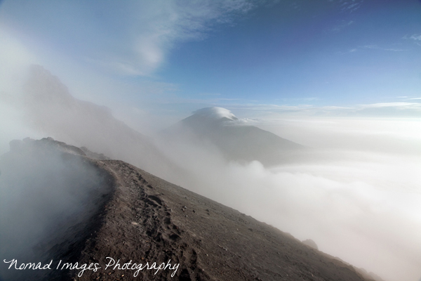
My hiking partner surveys the sunrise, a mix of mist and sulphurous gases
From the junction in Selo you follow the road directly up the hill to the New Selo signs, you will pass basecamp on the left side of the road a little bit before the New Selo sign and here u can also take snacks of hot noodles and sleep on a mat on the floor if need be.
I believe there is a small fee to pay at the Pos for entry onto the mountain but at 1.30am there was nobody around for me to pay and no log to sign into so people are aware that you are actually on the mountain. I wasn't taking a guide as I was assured by some good local friends who have climbed Merapi several times that it just wasn't necessary. If you do want to take a guide figure on 250,000 IDR these days for the round trip.
I did meet another individual though at this point so we decided to do the climb together. It turned out that we were the only people at the summit come sunrise which was a bonus as we didn't have falling rocks on traversing the scree section for the final ascent. It was during the week so the weekend crowds were nowhere to be seen.
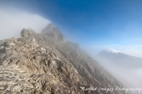
Gunung Merapi craters edge with Gunung Merbabu in the distance
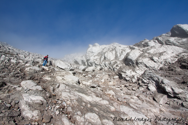
From New Selo it's a pleasant stroll on a sandy path beside terraced fields of tobacco and vegetables until you are naturally lead through the trees, there is a drop to the left which you will be aware of as the wind whistles through, eventually this gives way to rocky ground. Pos 1 at 2,150m is reached about 1 and half hours after leaving the New Selo sign. Memorial stones and plates are reached within another 30mins at 2,400m and then its a short way through boulder strewn area to Pasar Bubrah.

Pasar Bubrah as seen on the descent from Merapi crater
From Pasar Bubrah it's a 45min to 1 hour ascent to the crater rim through grey volcanic sand and scree. You will find yourself generally taking two steps forward and one step back, the calf muscles begin to burn and you will wonder when you will get to the stable rocky ground you see above the scree line. Once here it's a simple matter of onwards and upwards making your own path through this rocky craggy area until you reach the summit or at least the crater rim.
Stable but rocky ground just below the crater
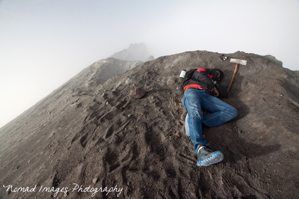
My friend catches some shuteye due to lack of sleep the previous day and night!
The true summit at present is to your right and extremely dangerous to try and bag, my recommendation unless you are a confident free climber is to be happy with arriving safely at the crater of one of the worlds most active volcanoes. And if your are luckier than me you may be peering into the awesome jaws of the crater devoid of sulphurous gases! The biting winds can be chilly up here too as the whole volcanic crater rim is openely exposed to the elements so better arrive there just as the sun is ready to rise.
Gunung Merapi - true summit to the rear, background right Gunung Merbabu
The descent is quite straight forward from the crater, I found the best way was to follow the rocks down pretty much to the right of the scree as you descend, keeping well off the scree which otherwise fills your footwear with grit. Its then a short distance veering left diagonally across the scree/sand back down to Pasar Bubrah.

Descending Mt. Merapi scree and sand slope
On the return to Pasar Bubrah it was nice to veer off the path to the left over the boulder field and after a gentle descent a short way you will have great lookout point to view the twin peaks of Gunung Sumbing and Gunung Sindoro along with Dieng plateau to the rear of these volcanic peaks. To the right is Gunung Merbabu and Gunung Ungaran in the distance.

Viewpoint as u descend from the Summit and Pasar Bubrah

Gunung Sumbing, Gunung Sindoro and the Dieng Plateau
From the New Selo sign to Mount Merapi summit took roughly four hours with a few short breaks on the way. Leaving at 1.30am and arriving at 5.30am to catch the first rays of the sunrise. Descent is half that time where back at the New Selo sign the car park will no doubt be full of local tourists admiring the view of Gunung Merbabu and Selo town itself over a coffee or soft drink available from one of the many warungs or small provisions stores there. It can be hot on the way down so bear in mind the need for a hat as the route is very open to the sunlight with little shade to be had along the way. One big bottle of water (1.5ltr) should be sufficient for the night climb. Good Luck.
View Larger Map
Interactive Google Maps Location Gunung Merapi (Mount Merapi)